même sujet
Eruppinatubo12
Sujet
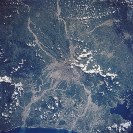
Mt. Pinatubo on the island of Luzon (15.0N, 120.0E) erupted catastrophically in June 1991 after over 600 years of inacti
Légende
Mt. Pinatubo on the island of Luzon 15.0N, 120.0E erupted catastrophically in June 1991 after over 600 years of inactivity. In this vertical view, the full extent of the eruption is obvious. Thick layers of ash completely surrounds the crater and the effect of mudflows in this previously heavily forested and agricultural region can be traced as ribbons flowing downhill. Clark AFB, once the crossroads of the SW Pacific can only partially be seen. Copyright: xpiemagsx piemagsspace-69376 ACHTUNG AUFNAHMEDATUM GESCHÄTZT
Info+
IMAGO/piemags
Date
1991
Crédit
Photo12/Imago
Notre référence
MGO25A07_226
Model release
Non
Licence
Droits gérés
Format disponible
49,3Mo (2,3Mo) / 35,1cm x 35,1cm / 4150 x 4150 (300dpi)