Légende
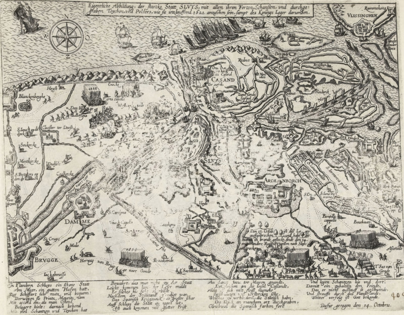
Actual depiction of the strong city of Sluys, with all its forts, redoubts, and excavated teychen, and polders, as they appear somewhat late 1621, together with the King's Army, Map of Sluis and surroundings besieged by the Spaniards, 1621, Series 11: Varia Foreign Events, 1571-1631, print, album page, map, Series number, 404, 380?, October 14, 1621. With caption of 26 lines in German. Numbered in pen at the bottom right: 404., inscription: '404', printmaker: workshop of Frans Hogenberg, Cologne, Frans Hogenberg, printmaker, North Rhine-Westphalia, paper, etching, height 220 mm x width 285 mm, maps of separate countries or regions, siege, position war, Siege of Sluis (1621), Sluis, Period, 1621-10-14, A detailed monochrome map showing coastlines, waterways, fortifications, towns, fields, and labeled place names in an old script, with drawn ships and sailing vessels in the sea, clusters of tents and formations of soldiers on land, stylized compass rose, small buildings and churches, bridges and canals, winding roads and dotted boundary lines, trees and hedges, shaded hills and sandbanks, numerous small cartographic symbols and decorative border text along the top and bottom.
Crédit
Photo12/Liszt Collection
Notre référence
LZT26B46_022
Licence
Droits gérés
Format disponible
58.5Mo (9.7Mo) / 43.3cm x 33.8cm / 5110 x 3998 (300dpi)