Légende
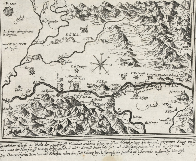
Map of Friuli, 1617, Eigentlicher Abriss des theils der landschafft Friaul, Series 11: Varia Buitenlandse Gebeurtenissen, 1571-1631, print, album page, map, Series number, 386, 380?, Map of the region of Friuli, around the city of Gradisca, July 1, 1617. In the caption, the title in 3 lines in German. Numbered in pen in the lower right corner: 386., inscription: '386', printmaker: workshop of Frans Hogenberg, Cologne, North Rhine-Westphalia, paper, etching, height 202 mm x width 222 mm, maps of separate countries or regions, Friuli-Venezia Giulia, Gradisca, Period, 1617-07-01, A detailed black and white engraved map showing winding rivers, stylized mountain ranges, and scattered small fortress-like town icons, with numerous handwritten labels beside features; a decorative compass rose sits near the center, small star-shaped emblems mark certain locations, and various flags and banner symbols appear by specific sites; the map is bordered and above a wide band of cursive descriptive text at the bottom.
Crédit
Photo12/Liszt Collection
Notre référence
LZT26B46_013
Licence
Droits gérés
Format disponible
33.8Mo (8.7Mo) / 32.0cm x 26.4cm / 3785 x 3117 (300dpi)