Légende
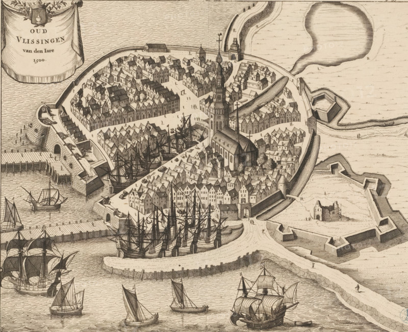
Old Vlissingen of the Year 1500, Map of Vlissingen, 1500, print, book illustration, Bird's-eye view map of Vlissingen, as it would have looked around 1500. In the upper left a cartouche with the title and the city's coat of arms. Cut off within the plate margin so numbering in the upper right only partially visible Page 556., printmaker: Johannes Meertens (possibly), Middelburg, publisher: Abraham van Someren (possibly), Amsterdam, 1696, paper, etching, engraving, height 275 mm x width 337 mm, Current state of print also used in: Smallegange, Mattheus. Nieuwe Cronyk van Zeeland (…). Middelburg and Amsterdam: Johannes Meertens and Abraham van Someren, 1696. Later state of print (without numbering in the upper right) also used in: Aa, Pieter van der. La galerie agreable du monde, 66 volumes. Leiden: Pieter van der Aa, 1728, vol. 21., coat of arms (as symbol of the state, etc.) (city, municipal), maps of cities, Flushing, A detailed aerial view of a walled coastal town with densely packed gabled buildings and narrow streets clustered around a large church with a tall tower and spire; a curved waterfront with piers and quays shelters numerous sailing ships with masts and rigging, some docked and some under sail in the surrounding waters; fortifications including bastions, ramparts, a sea gate, and angled defensive walls extend into the water; small figures of people appear on streets, quays, and the fortifications; an ornamental cartouche hangs over the sea showing a draped cloth and a crest.
Crédit
Photo12/Liszt Collection
Notre référence
LZT26B34_174
Licence
Droits gérés
Format disponible
36.1Mo (12.0Mo) / 33.4cm x 27.1cm / 3940 x 3203 (300dpi)