Légende
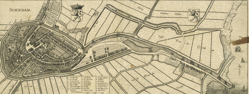
Schiedam, Map of Schiedam, area plan, print, Map in bird's-eye view perspective. Top left the title, to the right of that the coat of arms of Holland and top right the coat of arms of Schiedam. Bottom left of center the legend 1-24 and the scale bar: 720 Pedes geometrici., printmaker, Johannes Janssonius, Johannes Janssonius van Waesberge (II), paper, etching, engraving, height 202 mm, width 514 mm, An aged, detailed map view rendered in sepia tones shows a fortified town with concentric streets and densely packed buildings surrounded by walls and canals, with bridges crossing water channels and ships visible in surrounding waters; adjacent areas display parcelled fields divided by straight ditches, linear roads, and scattered small structures, while decorative heraldic shields and small windmills appear in some open spaces, and a boxed legend occupies a panel at the bottom.
Crédit
Photo12/Liszt Collection
Notre référence
LZT26B34_132
Licence
Droits gérés
Format disponible
39.5Mo (6.9Mo) / 51.0cm x 19.4cm / 6028 x 2289 (300dpi)