Légende
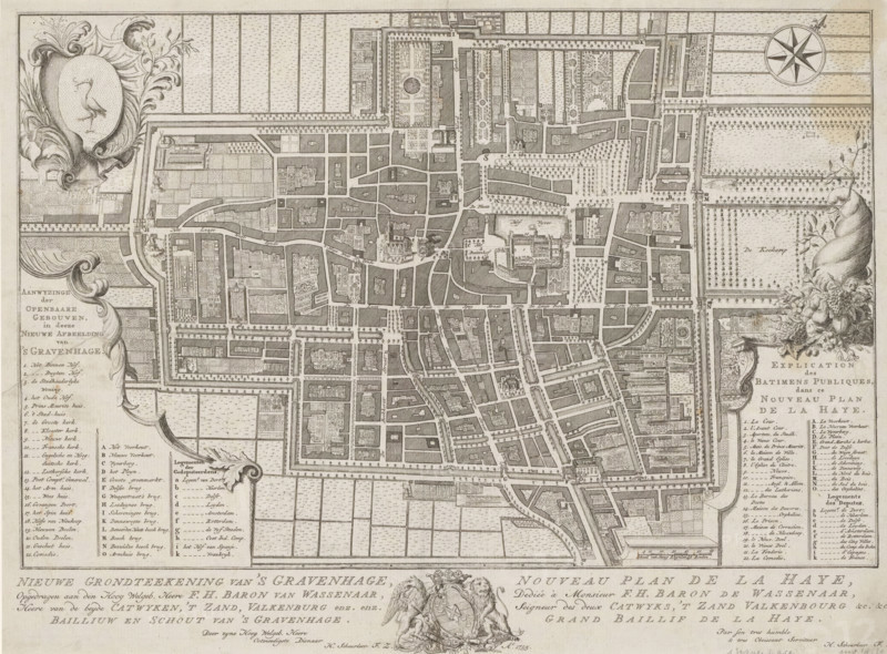
New ground plan of The Hague, Nouveau plan de La Haye, Map of The Hague, area plan, print, Map with buildings in bird's-eye perspective. Top left the coat of arms of The Hague, below that a Dutch legend 1-22, AO and ak. On the right a French legend 1-22, AO and ak. To the left of that a scale bar: Scale of sixty Rhineland rods. Below the map the title and dedication in Dutch and French, with the coat of arms of Frederik Hendrik baron van Wassenaer in the middle., printmaker: Iven Besoet (possibly), The Hague, publisher: Hendrik Florisz Scheurleer, dedicated by: Hendrik Florisz Scheurleer, dedicated to: Frederik Hendrik baron van Wassenaer, 1755, Iven Besoet, Hendrik Florisz Scheurleer, Frederik Hendrik baron van Wassenaer, printmaker, publisher, paper, engraving, etching, height 318 mm x width 425 mm, armorial bearing, heraldry, coat of arms (as symbol of the state, etc.) (city, municipal), maps of cities, A detailed monochrome engraved map showing a city layout with a network of streets, canals, bridges, blocks of buildings, gardens, and tree-lined avenues, surrounded by a border with patterned fields and decorative cartouches; ornate scrollwork and floral embellishments appear in the corners, including a shield with a bird on the left and a floral arrangement on the right, plus a compass rose near the top right; numerous small building footprints and courtyard patterns are rendered throughout the map, and there are dense areas of tiny trees indicating orchards or planted grounds; decorative title panels and lists of entries with framed borders are visible along the left and right margins and at the bottom, and an ornate coat of arms with supporters is centered near the bottom margin.
Crédit
Photo12/Liszt Collection
Notre référence
LZT26B34_126
Licence
Droits gérés
Format disponible
53.3Mo (7.0Mo) / 42.5cm x 31.4cm / 5021 x 3709 (300dpi)