Légende
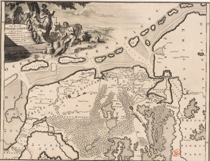
Historical map of the Netherlands with the territories of the Batavians and Frisians, Pars II et III Frisiae liberae a flevo in Lavicam, print, map, historical print, Map of the Frisian territories in the northern Netherlands in the Roman period. In the upper left, a cartouche with title, next to it a woman carrying the horn of plenty (possibly Concordia), Justitia, and a kneeling male figure. Scale bar below cartouche: Triens gradus. Degree division along left and right edges., printmaker: Gerrit de Broen (I), Amsterdam, printmaker: Joseph Mulder, writer (clerical worker): Menso Alting, 1697 - 1700, 1725, writer (clerical worker), paper, engraving, etching, height 318 mm x width 419 mm, Part of 16 maps of the land of the Batavians and the Frisians first produced for and included in Alting, Menso. Descriptio, secundum antiquos, agri Batavi & Frisii. 2 volumes. Amsterdam: Henricus Wetstein, 1697-1700. Reused in Halma, François. Tooneel der Vereenigde Nederlanden, en onderhorige landschaps, 2 volumes. Leeuwarden: Hendrik Halma, 1725. This map was used in Halma's Tooneel der Vereenigde Nederlanden (1725) and can probably be found in part 1, p. 337., maps of separate countries or regions, Justitia (justice) as Roman personification, Concordia as Roman personification, Roman period in the Netherlands, Batavians, Frisians, Netherlands, Friesland, A detailed engraved map with coastlines, islands, peninsulas, rivers, and inland terrain, rendered in fine line work and stippling; the upper left shows a vignette of three classical figures beside a tree and a horse, one seated holding a cornucopia and another standing with scales, barrels stacked nearby and a reclining bull and a man tending sheep at the water’s edge; the sea areas are filled with patterns indicating shallows and currents and dotted islands with raised, shaded outlines; the land areas show v
Crédit
Photo12/Liszt Collection
Notre référence
LZT26B34_053
Licence
Droits gérés
Format disponible
53.5Mo (6.7Mo) / 41.8cm x 32.1cm / 4939 x 3789 (300dpi)