Légende
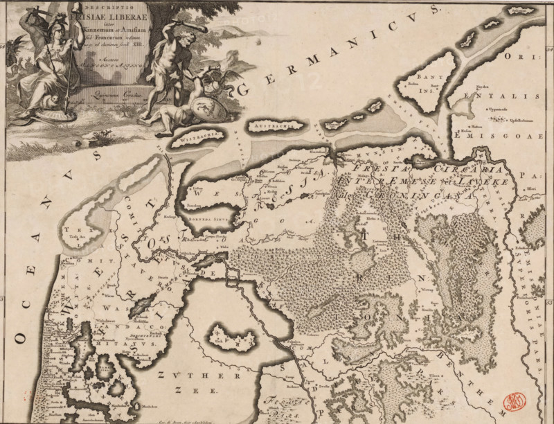
Historical map of the Netherlands with the territories of the Batavians and Frisians, Descriptio Frisiae liberae inter Kinnemum et Amisian, print, map, historical print, Map of the Frisian territories in the present-day Netherlands and Germany in Roman times. Top left cartouche with title, surrounding the cartouche a man with a sword, the Dutch Maiden with a lance on which the Phrygian cap hangs, and Hercules defeating a blindfolded man. Scale bar below cartouche: Quincunx gradus. Degree division along left and right edges., printmaker: Gerrit de Broen (I), Amsterdam, writer (clerical worker): Menso Alting, 1697 - 1700, 1725, writer (clerical worker), paper, engraving, etching, height 317 mm x width 419 mm, Part of 16 maps of the land of the Batavians and the Frisians first produced for and included in Alting, Menso. Descriptio, secundum antiquos, agri Batavi & Frisii. 2 volumes. Amsterdam: Henricus Wetstein, 1697-1700. Reused in Halma, François. Tooneel der Vereenigde Nederlanden, en onderhorige landschaps, 2 volumes. Leeuwarden: Hendrik Halma, 1725. This map was used in Halma's Tooneel der Vereenigde Nederlanden (1725) and can probably be found in part 1, p. 334., maps of separate countries or regions, Roman period in the Netherlands, Batavians, Frisians, Netherlands, Germany, An aged engraved map segment showing coastlines, islands, rivers, and inland terrain rendered with dense stippling and hachure; the map includes numerous small place labels in an old-style serif script, decorative cartouche artwork in the upper left depicting classical figures and a seated woman with a spear beside a reclining lion and a partially draped male figure holding a club over another fallen figure with a shield, a small sailing ship on the sea near distant low hills, clusters of trees and textured forests inland, dotted and shaded shoals and banks along the coasts, a circular stamped seal in red ink near the lower right cor
Crédit
Photo12/Liszt Collection
Notre référence
LZT26B34_051
Licence
Droits gérés
Format disponible
52.0Mo (6.6Mo) / 41.3cm x 31.6cm / 4873 x 3733 (300dpi)