Légende
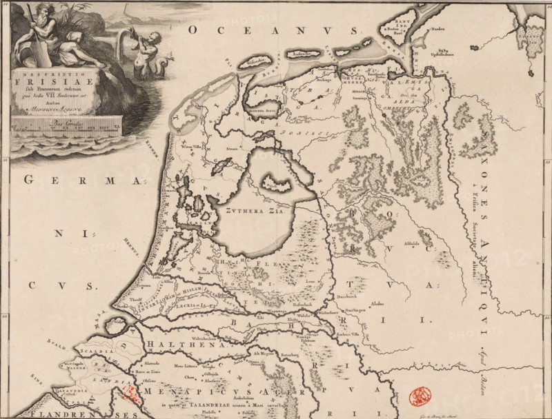
Historical map of the Netherlands with the territories of the Batavians and Frisians, Descriptio Frisiae sub Francorum reditum, print, map, historical print, Map of the Netherlands and Germany in Roman times with the area where the Frisians lived. In the upper left, a cartouche with title, a river god, and a triton. Scale bar below cartouche: Bes gradus. Degree division along left and right edges., printmaker: Gerrit de Broen (I), Amsterdam, writer (clerical worker): Menso Alting, 1697 - 1700, 1725, writer (clerical worker), paper, engraving, etching, height 317 mm x width 417 mm, Part of 16 maps of the land of the Batavians and the Frisians first produced for and included in Alting, Menso. Descriptio, secundum antiquos, agri Batavi & Frisii. 2 volumes. Amsterdam: Henricus Wetstein, 1697-1700. Reused in Halma, François. Tooneel der Vereenigde Nederlanden, en onderhorige landschaps, 2 volumes. Leeuwarden: Hendrik Halma, 1725. This map was used in Halma's Tooneel der Vereenigde Nederlanden (1725) and can probably be found in part 1, p. 114., maps of separate countries or regions, river-gods, triton(s), Roman period in the Netherlands, Batavians, Frisians, Netherlands, Germany, Friesland, A sepia-toned map fragment showing a coastal region with intricate inked shorelines, islands, rivers, and inland waters rendered with stippling and hatching, populated by small hand-drawn terrain textures indicating forests and hills. The left margin features an engraved cartouche with two reclining male figures, one holding a staff and the other pouring water from a vessel, positioned above decorative waves and a stone plaque. The sea area near the top contains stylized wave lines and scattered island shapes, while the land is filled with numerous fine labels and tiny town markers alongside winding waterways and clustered wooded areas. A round red stamp appears near the lower right quadrant, and fine border lines frame the ma
Crédit
Photo12/Liszt Collection
Notre référence
LZT26B34_050
Licence
Droits gérés
Format disponible
52.4Mo (5.9Mo) / 41.5cm x 31.6cm / 4907 x 3735 (300dpi)