Légende
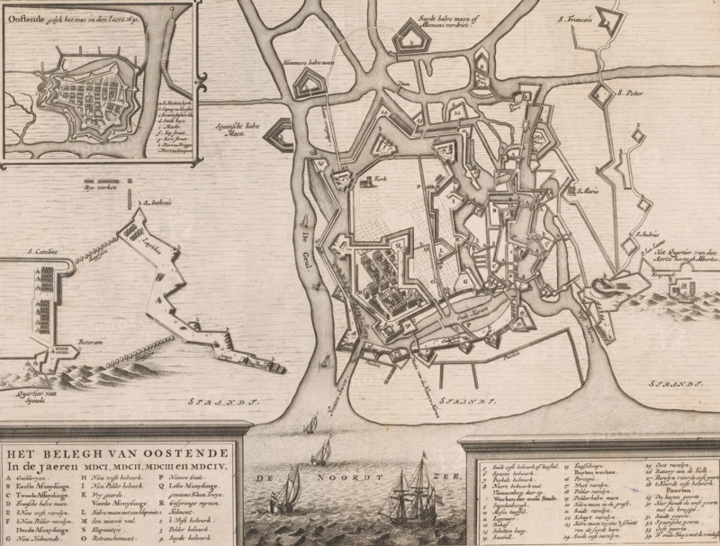
Siege plan of Ostend, The siege of Ostend in the years MDCI, MDCII, MDCIII and MDCIV, area plan, print, c. 1650 - c. 1750, printmaker, paper, etching, engraving, height 277 mm x width 363 mm, This print is most likely a copy of the print published by Blaeu in 1649, 1652 (Koeman 3175, IV.1242)., siege, fortified city, Siege of Ostend, Ostend, Period, 1601 - 1604, A detailed, vintage map printed in sepia tones showing a fortified coastal city with angular bastions, walls, canals, narrow streets, and labeled districts; surrounding waters with drawn sailing ships and small boats; inset maps of additional fortifications and harbor works; hand-drawn topographical shading for land and sea; decorative cartouche areas containing blocks of text and lists; numerous small building blocks, clustered trees, and geometric defensive works arrayed along waterways and shoreline.
Crédit
Photo12/Liszt Collection
Notre référence
LZT26B33_098
Licence
Droits gérés
Format disponible
47.9Mo (6.3Mo) / 39.8cm x 30.2cm / 4698 x 3565 (300dpi)