Légende
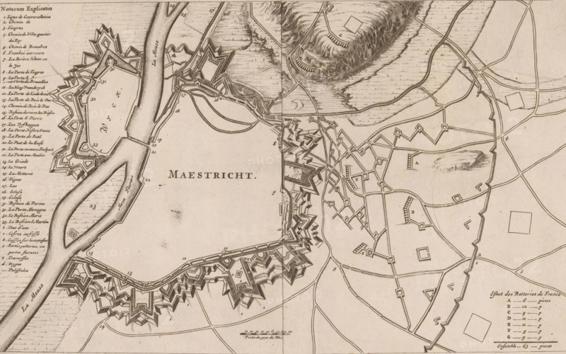
Maestricht, Fortification map of Maastricht, 1673, area plan, print, On the left a French legend 1-33. Possibly a fortification map from the Siege of Maastricht by the French, 1673., 1673 - 1675, printmaker, paper, etching, height 180 mm x width 294 mm, maps of cities, fortified city, Maastricht, Period, 1673-06-13 - 1673-06-26, A sepia-toned historical map showing a fortified town outlined by star-shaped ramparts and bastions along a river bend, with the river depicted as a wide curving waterway and labeled in large letters; the central area within the fortifications contains open space with faint textures and scattered small geometric shapes; surrounding the main fortress are networks of roads and paths connecting additional smaller fortifications, angular earthworks, and rectangular plots, with some hachured hills and textured terrain to the upper right; along the left edge is a vertical column of dense handwritten list entries, and the lower right corner contains a small legend with grouped entries and short lines; the map features fine engraved linework, dotted shading in water and hills, and numerous small numeric markers adjacent to features.
Crédit
Photo12/Liszt Collection
Notre référence
LZT26B33_068
Licence
Droits gérés
Format disponible
42.7Mo (11.6Mo) / 41.3cm x 25.9cm / 4880 x 3056 (300dpi)