Légende
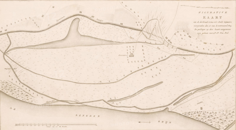
Map of dike breach at Loo, 1809, Figurative Map of the breach at Loo in the Lijmers district occurred on the 13th of January 1809, print, map, Map of the breach of the Liemers Bandijk along the Lower Rhine near Loo in Gelderland, January 13, 1809., printmaker, Netherlands, paper, etching, engraving, height 285 mm x width 492 mm, Used as illustration in: Ewijk, Hendrik. Historical report of the dike breaches and floods along the rivers in the Kingdom of Holland, occurred in January 1809. 3 vols. Amsterdam: Johannes Allart and Jacobus Ruys, maps of separate countries or regions, dike-break, Flood of 1809, Gelderland, Lower Rhine region, Period, 1809-01-13, A sepia-toned map view showing a wide river along the bottom edge with contour shading, a long curving island or sandbank with layered contour lines near the top center, roads or paths meandering across the map, small rectangular building shapes scattered on both sides of the central area, clusters of individual tree symbols arranged in groves and along lines, thin dashed and solid boundary lines crossing fields, elongated narrow islands or bars in the water, a small square tower-like shape surrounded by evenly spaced tree symbols, areas with short parallel hatch marks indicating slopes or embankments, a boxed title block in the upper right with decorative text, a linear scale bar and simple north arrow near the bottom, and numerous tiny marks across the plain areas that resemble repetitive small symbols.
Crédit
Photo12/Liszt Collection
Notre référence
LZT26B33_031
Licence
Droits gérés
Format disponible
56.2Mo (11.4Mo) / 50.5cm x 27.9cm / 5961 x 3297 (300dpi)