Légende
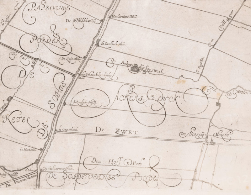
Map of the Schieland Water Board, with De Zweth, print, map, printmaker: Floris Balthasarsz. van Berckenrode, printmaker: Balthasar Florisz. van Berckenrode, commissioner (person who orders works): Schieland Water Board, 1611 - 1635, commissioner (person who orders works), paper, etching, engraving, height 219 mm x width 293 mm, This map was published five times between 1611 and 1635 without the plates being updated. Unclear to which edition this copy belongs., armorial bearing, heraldry, maps of separate countries or regions, Schieland, A sepia-toned, hand-drawn map fragment with flowing calligraphic lines and ornamental swirls, featuring narrow straight and curved boundary lines, irregularly shaped enclosed plots, linear canal or road with parallel edging running vertically, tiny clustered building symbols along some lines, small circular and oval decorative loops within larger fields, scattered faint stains and smudges on the paper, and fine pen strokes showing texture and age across the surface.
Crédit
Photo12/Liszt Collection
Notre référence
LZT26B32_498
Licence
Droits gérés
Format disponible
55.7Mo (10.2Mo) / 42.4cm x 32.9cm / 5003 x 3891 (300dpi)