Légende
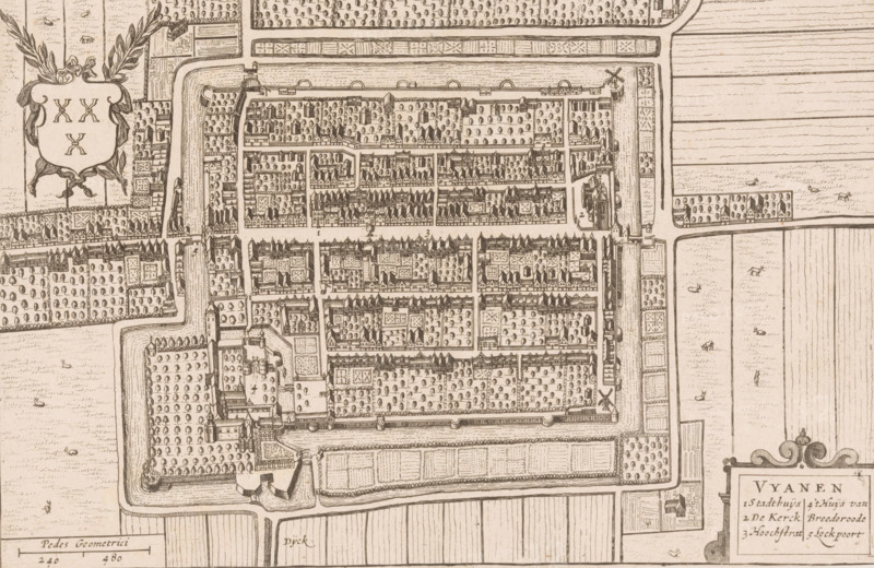
Vyanen, Map of Vianen, area plan, print, printmaker, Johannes Willemszoon Blaeu, Hendrick Hondius, paper, etching, height 149 mm x width 226 mm, Print used in: Boxhorn, Marcus Zuerius van. Theatrum sive Hollandiae comitatus et urbium nova descriptio (…). Amsterdam: Henricus Hondius, 1632., maps of cities, Vianen, A detailed hand-drawn map rendered in sepia tones showing a walled town with rectangular blocks of buildings and tree-filled courtyards arranged in a grid, surrounded by moats and outer fields; the town contains rows of pitched-roof structures, churches or larger roofed buildings, small towers at corners of the walls, gates opening to causeways, and windmills near the perimeter; outside the walls are patterned agricultural fields with scattered small figures and animals, ornamental borders, and decorative cartouches and laurel motifs at the edges.
Crédit
Photo12/Liszt Collection
Notre référence
LZT26B32_333
Licence
Droits gérés
Format disponible
58.4Mo (6.5Mo) / 47.4cm x 30.9cm / 5598 x 3644 (300dpi)