Légende
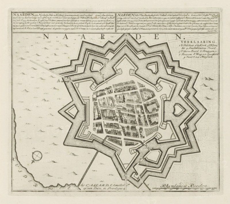
Map of Naarden, Naarden, a Dutch city in Holland, Les Principales Forteresses & Villes Fortes, d'Espagne, de France, d'Italie, de Savoië, d'Allemagne & des Païs-Bas, Naaukeurige Illustratie der Voornaamste Sterke Steden en Vestingen in Spanjen, Vrankryk, Italien, Savoyen, Duytsland en Nederlanden, print, album page, map, Map of the Dutch city of Naarden. With texts in Dutch and French., printmaker: Abraham Allard, Amsterdam, printmaker: Carel Allard, publisher: Carel Allard, publisher: Pieter van der Aa (I), Leiden, grantor of privilege: States of Holland and West Friesland, 1701 - 1733, Abraham Allard, Carel Allard, Pieter van der Aa (I), States of Holland and West Friesland, publisher, grantor of privilege, paper, etching, height 239 mm x width 275 mm, fortifications, military engineering, maps of cities, War of Spanish Succession, Period, 1701 - 1713, A detailed black and white engraved map fragment showing a star-shaped fortified town with multiple concentric ramparts and angular bastions surrounded by water, an inner area filled with densely arranged rows of small building blocks and narrow streets, small clustered trees and a few isolated larger structures, a compass rose off to the left with a small decorative flourish, scattered small mound-like marks across the surrounding sea area, a long straight causeway or road leading toward the fortification, fine hatching and stippling used for shading on walls and water, and rectangular panels with dense engraving along the top edge.
Crédit
Photo12/Liszt Collection
Notre référence
LZT26B29_171
Licence
Droits gérés
Format disponible
55.4Mo (11.1Mo) / 39.6cm x 35.1cm / 4676 x 4141 (300dpi)