Légende
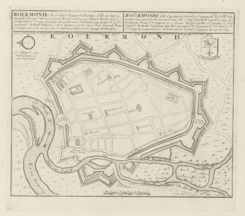
Roermond, d Capital of Spanish Gelderland, 1702 7 Oct: passed to the United States after a siege of 7 days, Map of Roermond, Les Principales Forteresses & Villes Fortes, d'Espagne, de France, d'Italie, de Savoië, d'Allemagne & des Païs-Bas, Accurate Illustrations of the Main Strong Cities and Fortresses in Spain, France, Italy, Savoy, Germany and the Netherlands, print, album page, map, Map of the city of Roermond. Transferred to the United Netherlands after siege, October 7, 1702. With texts in Dutch and French., printmaker: Abraham Allard, Amsterdam, printmaker: Carel Allard, publisher: Carel Allard, publisher: Pieter van der Aa (I), Leiden, grantor of privilege: States of Holland and West Friesland, 1702 - 1733, Abraham Allard, Carel Allard, Pieter van der Aa (I), States of Holland and West Friesland, publisher, grantor of privilege, paper, etching, height 247 mm x width 282 mm, fortifications, military engineering, maps of cities, War of Spanish Succession, Capture of Roermond (1702), Roermond (Limburg), Period, 1702-10-07, 1701 - 1713, A detailed black and white map showing a walled town with angular bastions and fortifications surrounded by waterways, with a river bending and branching around the town, a network of rectilinear streets and labeled blocks inside the walls, small square and rectangular building footprints, bridges connecting parts of the town to outer fortifications, a compass rose near the top left, a decorative cartouche with a crest near the top right, finely hatched shading to indicate walls and water, and a border framing the entire map.
Crédit
Photo12/Liszt Collection
Notre référence
LZT26B29_167
Licence
Droits gérés
Format disponible
57.3Mo (11.3Mo) / 40.4cm x 35.6cm / 4771 x 4200 (300dpi)