Légende
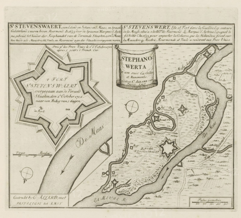
St Stevenswaert, an island and redoubt in the Meuse, in Spanish Gelderland, 2 hours north of Roermond, Plan of the fort of Stevensweert, Les Principales Forteresses & Villes Fortes, d'Espagne, de France, d'Italie, de Savoië, d'Allemagne & des Païs-Bas, Accurate Illustrations of the Main Strong Cities and Fortresses in Spain, France, Italy, Savoy, Germany and the Netherlands, print, album page, map, Plan of the fort of Stevensweert with a map of the wider area. Transferred to the United Netherlands after siege, October 2, 1702. With texts in Dutch, French, and Latin., printmaker: Abraham Allard, Amsterdam, printmaker: Carel Allard, publisher: Carel Allard, publisher: Pieter van der Aa (I), Leiden, grantor of privilege: States of Holland and West Friesland, 1702 - 1733, Abraham Allard, Carel Allard, Pieter van der Aa (I), States of Holland and West Friesland, publisher, grantor of privilege, paper, etching, height 247 mm x width 288 mm, fortress, maps of cities, War of Spanish Succession, Capture of Stevensweert (1702), Stevensweert, Period, 1701 - 1713, 1702-10-02, A detailed black and white engraved map fragment showing a winding river with textured water shading, star-shaped fort outlines along the riverbanks, a large multi-pointed bastion plan on the left, a decorative hanging banner with draped cloth, compass roses, small rectangular and square symbols scattered across the landscape, networks of curving roads or paths, clusters of tiny tree-like marks indicating vegetation, fields rendered with parallel hatch marks, and a ruled border framing the image.
Crédit
Photo12/Liszt Collection
Notre référence
LZT26B29_166
Licence
Droits gérés
Format disponible
56.3Mo (11.9Mo) / 39.4cm x 35.7cm / 4659 x 4221 (300dpi)