Légende
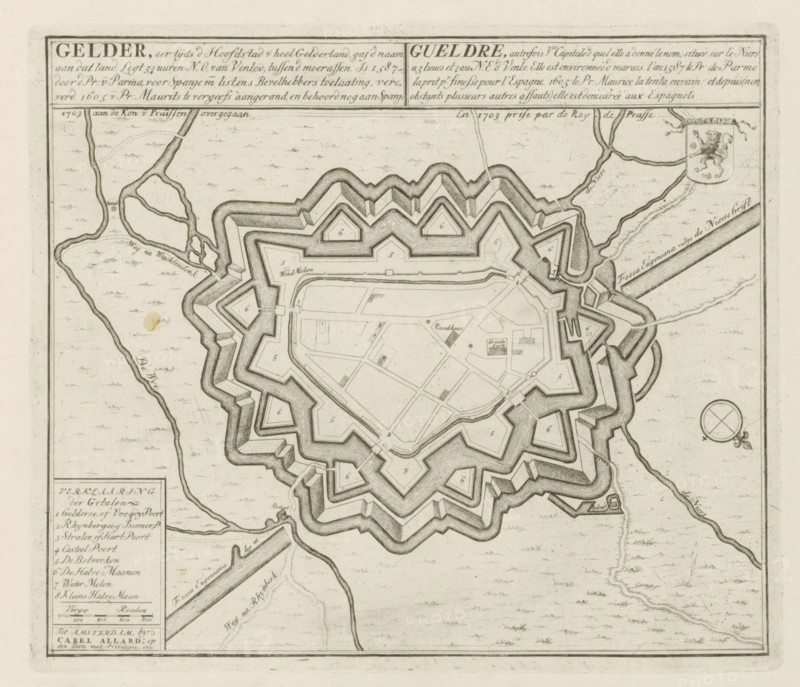
Map of Geldern, Gelder, formerly the capital of all Gelderland, passed to the King of Prussia in 1703, Les Principales Forteresses & Villes Fortes, d'Espagne, de France, d'Italie, de Savoië, d'Allemagne & des Païs-Bas, Accurate Illustrations of the Main Strong Cities and Fortresses in Spain, France, Italy, Savoy, Germany and the Netherlands, print, album page, map, Map of the city of Geldern (Gelder), besieged and conquered by the Prussian troops on December 17, 1703. With texts in Dutch and French., printmaker: Abraham Allard, Amsterdam, printmaker: Carel Allard, publisher: Carel Allard, publisher: Pieter van der Aa (I), Leiden, grantor of privilege: States of Holland and West Friesland, 1703 - 1733, Abraham Allard, Carel Allard, Pieter van der Aa (I), States of Holland and West Friesland, publisher, grantor of privilege, paper, etching, height 235 mm x width 275 mm, fortifications, military engineering, maps of cities, War of Spanish Succession, Siege and capture of Geldern (1703), North Rhine-Westphalia, Geldern, Period, 1701 - 1713, 1703-12-17, A detailed ink map fragment showing a star-shaped fortified town with multiple layered bastions and angular outer walls surrounded by water-filled moats, inner streets forming geometric patterns, and small rectangular and triangular building outlines; winding rivers and canals flow around and away from the fortress, with sinuous banks and scattered small islands, and a circular compass rose appears near the right edge; the map area includes hachured shading to indicate depth and elevation, small clusters of dots and stippling across the surrounding land, and a decorative shield with an animal motif near the upper right, while a boxed legend panel with faint list elements is visible in the lower left.
Crédit
Photo12/Liszt Collection
Notre référence
LZT26B29_165
Licence
Droits gérés
Format disponible
53.6Mo (11.1Mo) / 39.5cm x 34.0cm / 4669 x 4012 (300dpi)