Légende
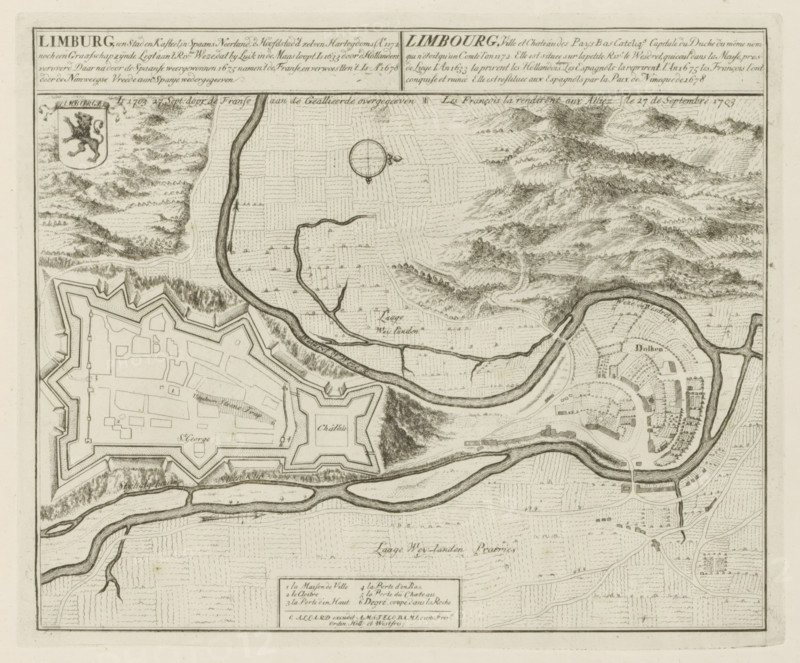
Map of Limburg, Limburg, a city and castle, in the Spanish Netherlands, Is 1703 27 Sept: surrendered by the French to the Allies, Les Principales Forteresses & Villes Fortes, d'Espagne, de France, d'Italie, de Savoië, d'Allemagne & des Païs-Bas, Accurate Illustrations of the Main Strong Cities and Fortresses in Spain, France, Italy, Savoy, Germany and the Netherlands, print, album page, map, Map of the city of Limburg (Limbourg) in the Spanish Netherlands, conquered by the Allies from the French, 27 September 1703. With texts in Dutch and French., printmaker: Abraham Allard, Amsterdam, printmaker: Carel Allard, publisher: Carel Allard, publisher: Pieter van der Aa (I), Leiden, grantor of privilege: States of Holland and West Friesland, 1703 - 1733, Abraham Allard, Carel Allard, Pieter van der Aa (I), States of Holland and West Friesland, publisher, grantor of privilege, paper, etching, height 235 mm x width 284 mm, fortifications, military engineering, maps of cities, War of Spanish Succession, Siege of Limbourg, Limbourg city, Period, 1701 - 1713, 1703-09-27, A detailed ink map segment showing a fortified star-shaped fortress with angular bastions and internal rectangular buildings, adjacent to a smaller fortified chateau with geometric walls, both bordered by winding rivers and meandering waterways; areas of cultivated fields are indicated by patterned hatch marks, and tree-lined paths and wooded hills are shown with dense stippling and short strokes; a circular compass rose appears near the top center, and a small coat of arms with an animal figure is visible near the upper left; the right side shows a semicircular town layout with radially arranged streets and clustered buildings, surrounded by a river bend and embankments, while bridges and roads connect the various features across the landscape.
Crédit
Photo12/Liszt Collection
Notre référence
LZT26B29_164
Licence
Droits gérés
Format disponible
53.1Mo (9.9Mo) / 40.0cm x 33.2cm / 4729 x 3922 (300dpi)