Légende
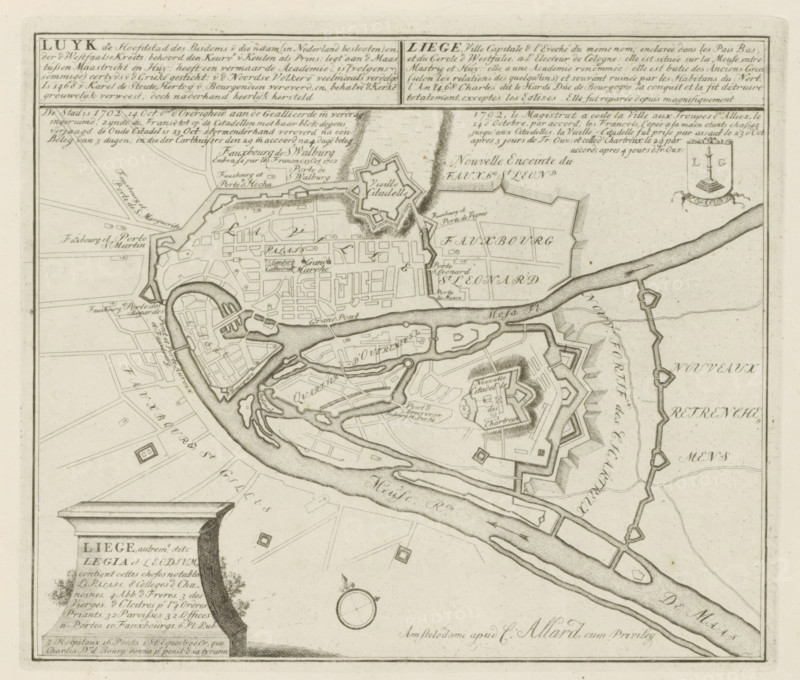
Luyk, the capital of the diocese of that name, the City is 1702, 14 Oct. allocated by the authorities to the Allies by treaty, Map of Liège, Les Principales Forteresses & Villes Fortes, d'Espagne, de France, d'Italie, de Savoië, d'Allemagne & des Païs-Bas, Accurate Illustrations of the Principal Strong Cities and Fortresses in Spain, France, Italy, Savoy, Germany and the Netherlands, print, album page, map, Map of the city of Liège, captured by the Allies from the French, October 14-29, 1702. With texts in Dutch and French., printmaker: Abraham Allard, Amsterdam, printmaker: Carel Allard, publisher: Carel Allard, publisher: Pieter van der Aa (I), Leiden, grantor of privilege: States of Holland and West Friesland, 1702 - 1733, Abraham Allard, Carel Allard, Pieter van der Aa (I), States of Holland and West Friesland, publisher, grantor of privilege, paper, etching, height 238 mm x width 274 mm, fortifications, military engineering, maps of cities, War of Spanish Succession, Capture of Liège (1702), Liège, Period, 1701 - 1713, 1702-10-14 - 1702-10-29, A detailed black and white engraved map segment showing a fortified town with irregular bastioned walls, star-shaped citadels, and a network of streets and blocks; a winding river curves through and around the town with bridges and river islands; labelled areas and small rectangular plots indicate districts and faubourgs; numerous fortification lines, moats, and ramparts are depicted with hachured shading; decorative cartouches and panels with blocks of dense script appear at the top and bottom edges; a small circular compass rose is shown near the lower center; a shield-shaped coat of arms appears near the upper right with a column or pillar motif; fine engraved texture and stippling create tone and shading across buildings, water, and landscape.
Crédit
Photo12/Liszt Collection
Notre référence
LZT26B29_163
Licence
Droits gérés
Format disponible
51.6Mo (9.6Mo) / 39.0cm x 33.2cm / 4608 x 3917 (300dpi)