Légende
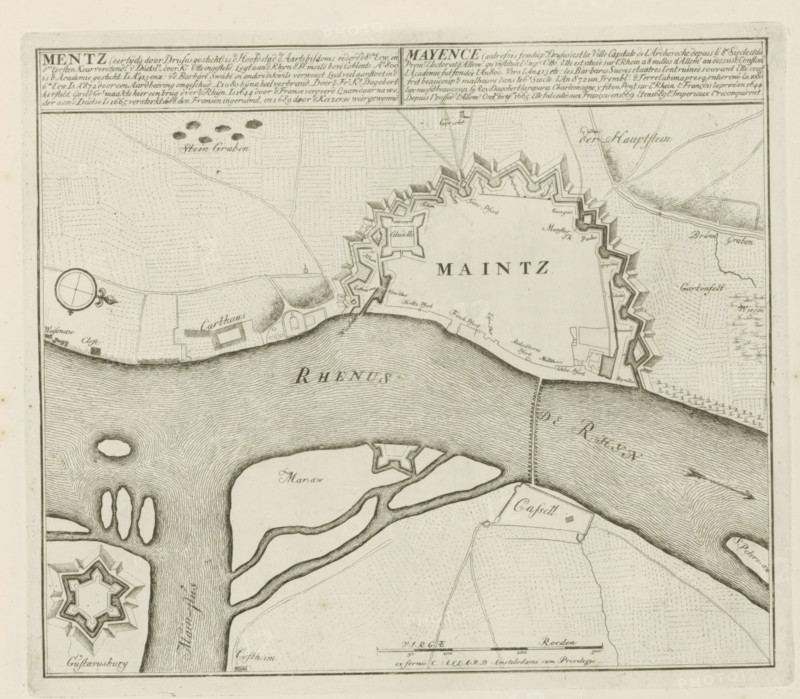
Map of Mainz, Mentz, is the capital of the archbishoprics, The Principal Fortifications & Fortresses of Spain, France, Italy, Savoy, Germany & the Netherlands, Accurate Illustrations of the Main Strong Cities and Fortifications in Spain, Germany and the Netherlands, print, album page, map, Map of the fortifications around the German city of Mainz, located on the Rhine. With texts in Dutch and French., printmaker: Abraham Allard, Amsterdam, printmaker: Carel Allard, publisher: Pieter van der Aa (I), Leiden, grantor of privilege: States of Holland and West Friesland, 1702 - 1733, paper, etching, height 239 mm x width 277 mm, fortifications, military engineering, maps of cities, War of Spanish Succession, Rhine, Rhineland-Palatinate, Mainz, Period, 1701 - 1713, A detailed black and white engraved map showing a fortified city with angular bastions along a riverbank, surrounding walls and a central citadel, adjacent water with rippling line shading and several islands, patterned fields and roads inland, small fortified outworks and a circular compass rose, fine hachure shading indicating terrain, and decorative border lines framing the image.
Crédit
Photo12/Liszt Collection
Notre référence
LZT26B29_157
Licence
Droits gérés
Format disponible
53.4Mo (9.5Mo) / 39.1cm x 34.2cm / 4620 x 4041 (300dpi)