Légende
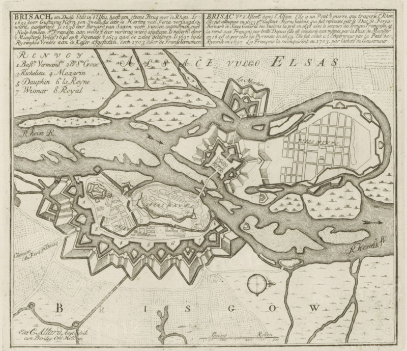
Brisach, a German city in Alsace, recaptured by the French in 1703, Map of Breisach, Les Principales Forteresses & Villes Fortes, d'Espagne, de France, d'Italie, de Savoy, d'Allemagne & des Païs-Bas, Accurate Illustrations of the Main Strong Cities and Fortresses in Spain, France, Italy, Savoy, Germany and the Netherlands, print, album page, map, Map of the fortifications around the German city of Breisach, conquered by the French in 1703. With texts in Dutch and French., printmaker: Abraham Allard, Amsterdam, printmaker: Carel Allard, publisher: Carel Allard, publisher: Pieter van der Aa (I), Leiden, grantor of privilege: States of Holland and West-Friesland, 1701 - 1733, Abraham Allard, Carel Allard, Pieter van der Aa (I), States of Holland and West-Friesland, publisher, grantor of privilege, paper, etching, height 239 mm x width 274 mm, fortifications, military engineering, maps of cities, War of Spanish Succession, Baden-Württemberg, Breisach, Period, 1701 - 1713, A detailed monochrome map showing a fortified town with star-shaped bastions and surrounding defensive walls, a grid-patterned area separated by water channels, winding rivers and islands with textured shading, small drawings of boats in the waterways, dense clusters of buildings inside the fortifications, geometric outworks and ramparts, dotted and hatched patterns indicating terrain, a circular compass rose, and a decorative cartouche area at the top with blocks of engraving.
Crédit
Photo12/Liszt Collection
Notre référence
LZT26B29_154
Licence
Droits gérés
Format disponible
48.0Mo (10.0Mo) / 37.4cm x 32.2cm / 4414 x 3803 (300dpi)