Légende
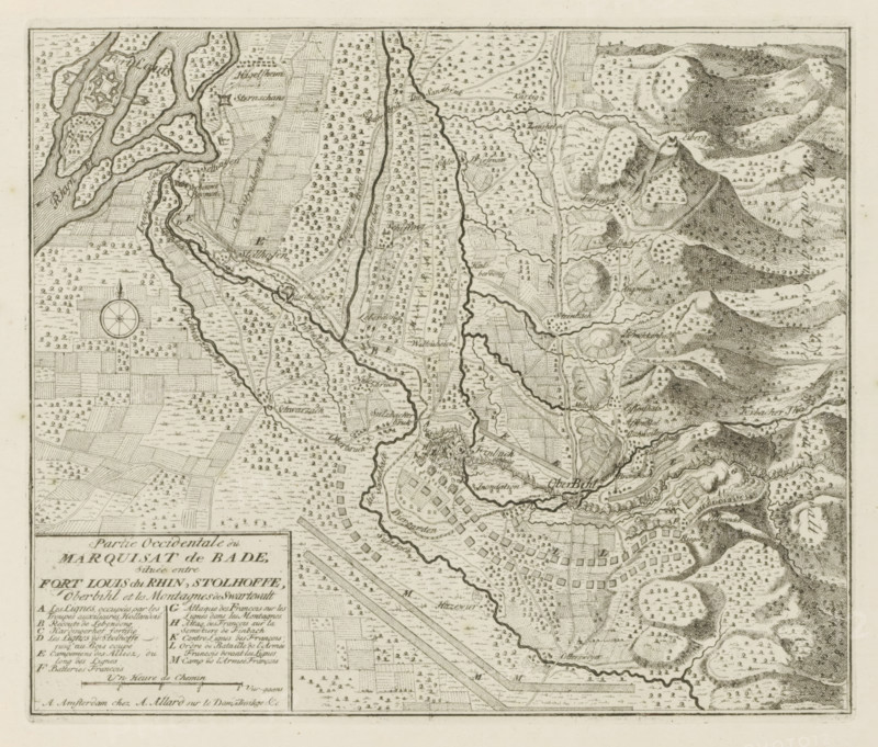
Western part of the Marquisate of Baden, situated between Fort Louis du Rhin, Stolhoffe, Oberbihl and the Mountains of Swartewalt, Markizaat Baden, The Principal Fortifications & Fortresses of Spain, France, Italy, Savoyard, Germany & the Netherlands, Accurate Illustrations of the Main Strong Cities and Fortresses in Spain, Savoy, Germany and the Netherlands, print, album page, map, Map of the west of the Markizaat of Baden on which the lines of the French and of the Allies and various battles are indicated. With texts in French., printmaker: Abraham Allard, Amsterdam, printmaker: Carel Allard, publisher: Pieter van der Aa (I), Leiden, grantor of privilege: States of Holland and West Friesland, 1701 - 1733, paper, etching, height 232 mm x width 274 mm, maps of separate countries or regions, War of Spanish Succession, Baden-Württemberg, Period, 1701 - 1713, An aged, detailed black-and-white map printed on paper showing rivers and winding waterways, clustered small rectangular and square field patterns, numerous tiny tree symbols scattered across plains and hills, densely shaded contour-like mountain and hill formations on the right side, a compass rose near the left-center, irregular winding roads and paths connecting settlements, small clusters of building shapes indicating towns and fortifications, a boxed legend area in the lower left with dense printed entries, finely hatched textures for water and terrain, and a thin border framing the entire map.
Crédit
Photo12/Liszt Collection
Notre référence
LZT26B29_152
Licence
Droits gérés
Format disponible
52.2Mo (11.0Mo) / 39.2cm x 33.4cm / 4628 x 3940 (300dpi)