Légende
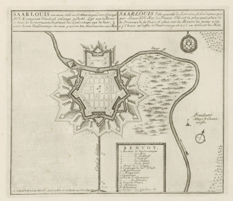
Map of Saarlouis, Saar-Louis a new city in Lorraine, recently founded by Louis XIV, King of France, Les Principales Forteresses & Villes Fortes, d'Espagne, de France, d'Italie, de Savoie, d'Allemagne & des Païs-Bas, Accurate Illustrations of the Main Strong Cities and Fortresses in Spain, France, Italy, Savoy, Germany and the Netherlands, print, album page, map, Map of the city of Saarlouis founded by Louis XIV in Saarland. With texts in Dutch and French., printmaker: Abraham Allard, Amsterdam, printmaker: Carel Allard, publisher: Carel Allard, publisher: Pieter van der Aa (I), Leiden, grantor of privilege: States of Holland and West Friesland, 1701 - 1733, Abraham Allard, Carel Allard, Pieter van der Aa (I), States of Holland and West Friesland, publisher, grantor of privilege, paper, etching, height 236 mm x width 275 mm, maps of cities, War of Spanish Succession, Saarland, Saarlouis, Period, 1701 - 1713, A detailed black and white engraved map fragment showing a star-shaped fortified town with concentric defensive works and inner grid of streets, surrounded by angled bastions and shaded hatching to indicate walls and ramparts; a winding river curves along one side with textured markings suggesting vegetation or marshland; a rectangular labeled legend box is inset below the fortress with a bordering frame; a simple compass rose appears near the river; patterned field textures fill the surrounding land; ornate decorative emblem with laurel wreath and intertwined monogram sits above the river near the top right; thin border lines frame the map.
Crédit
Photo12/Liszt Collection
Notre référence
LZT26B29_151
Licence
Droits gérés
Format disponible
52.3Mo (8.8Mo) / 38.9cm x 33.7cm / 4592 x 3982 (300dpi)