Légende
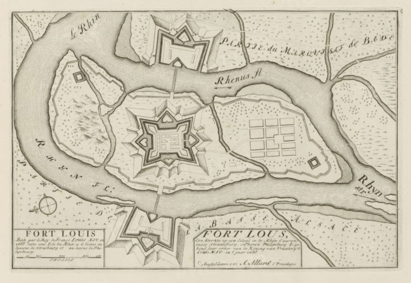
Plan of Fort Louis, Fort Lous, a fortress on an island in the Rhine, Les Principales Forteresses & Villes Fortes, d'Espagne, de France, d'Italie, de Savoië, d'Allemagne & des Païs-Bas, Accurate Illustrations of the Main Strong Cities and Fortresses in Spain, France, Italy, Savoy, Germany and the Netherlands, print, album page, map, built by the French in 1688, located on the Rhine near Strasbourg. With texts in Dutch and French., printmaker: Abraham Allard, Amsterdam, printmaker: Carel Allard, publisher: Carel Allard, publisher: Pieter van der Aa (I), Leiden, grantor of privilege: States of Holland and West Friesland, 1701 - 1733, Abraham Allard, Carel Allard, Pieter van der Aa (I), States of Holland and West Friesland, publisher, grantor of privilege, paper, etching, height 184 mm x width 275 mm, fortress, maps of cities, War of Spanish Succession, Rhine, Period, 1701 - 1713, A monochrome engraved map showing a river curving around an island with detailed hachure lines indicating water flow, star-shaped fortifications on the island and on the opposite bank, geometric bastions and angular walls, a grid of rectangular plots on one side of the island, winding smaller waterways and channels, scattered small tree or shrub symbols across the landscape, a compass rose near the lower left, and decorative border lines framing the image.
Crédit
Photo12/Liszt Collection
Notre référence
LZT26B29_150
Licence
Droits gérés
Format disponible
41.5Mo (7.5Mo) / 38.8cm x 26.8cm / 4583 x 3162 (300dpi)