Légende
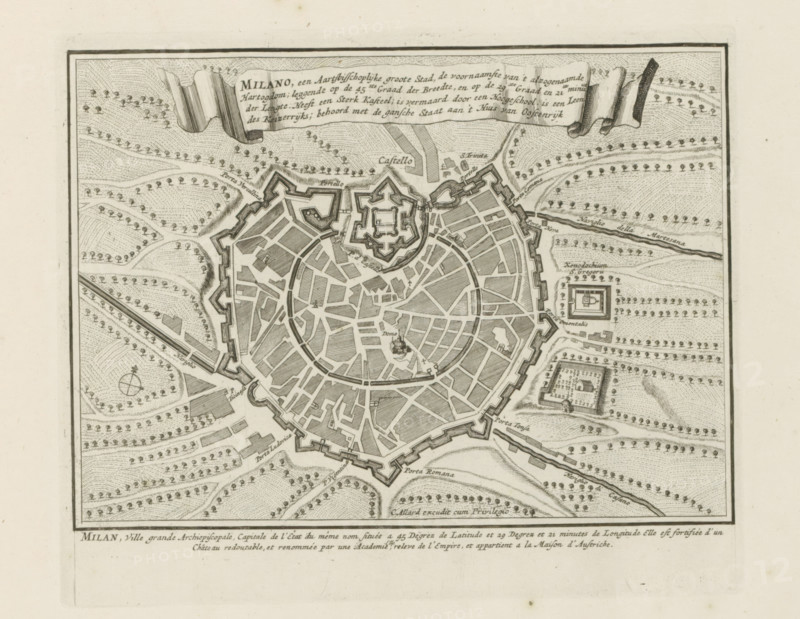
Milano, een archiepiscopal great city, Map of Milan, Les Principales Forteresses & Villes Fortes, d'Espagne, de France, d'Italie, de Savoy, d'Allemagne & des Païs-Bas, Accurate Illustrations of the Main Strong Cities and Fortresses in Spain, France, Italy, Savoy, Germany and the Netherlands, print, album page, map, Map of Milan. With texts in Dutch and French., printmaker: Abraham Allard, Amsterdam, printmaker: Carel Allard, publisher: Carel Allard, publisher: Pieter van der Aa (I), Leiden, grantor of privilege: States of Holland and West Friesland, 1701 - 1733, Abraham Allard, Carel Allard, Pieter van der Aa (I), States of Holland and West Friesland, publisher, grantor of privilege, paper, etching, height 181 mm x width 220 mm, maps of cities, War of Spanish Succession, Lombardy, Milan, Period, 1701 - 1713, An aged engraved map shows a walled circular city with radial streets and a central fortified citadel, rendered in fine black lines on a cream background; the city is surrounded by star-shaped bastions and outer walls, with patterned shading indicating buildings and open areas inside, and small tree symbols arranged in rows across the surrounding landscape; decorative ribbon banners appear at the top, and rectangular fortified structures appear outside the main walls with nearby roads and a river running along one side; a compass-like circular mark and various geometric field patterns appear in the countryside, and a thin border frames the entire illustration.
Crédit
Photo12/Liszt Collection
Notre référence
LZT26B29_147
Licence
Droits gérés
Format disponible
37.0Mo (8.6Mo) / 34.6cm x 26.8cm / 4089 x 3165 (300dpi)