Légende
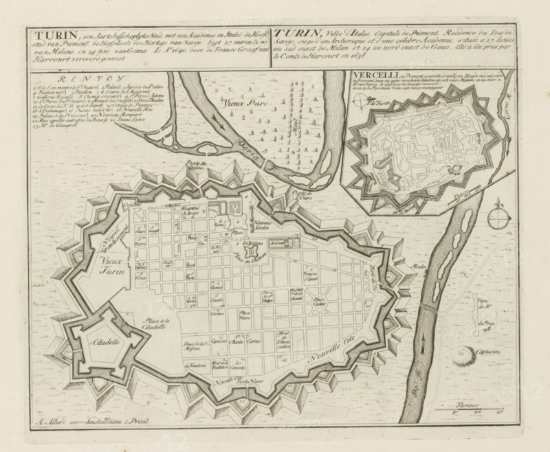
Map of Turin, Turin, an archiepiscopal city with an academy in Italy, Les Principales Forteresses & Villes Fortes, d'Espagne, de France, d'Italie, de Savoie, d'Allemagne & des Païs-Bas, Accurate Illustrations of the Main Strong Cities and Fortresses in Spain, France, Italy, Savoy, Germany and the Netherlands, print, album page, map, with an illustration of the city of Vercelli in the upper right. Texts in Dutch and French., printmaker: Abraham Allard, Amsterdam, printmaker: Carel Allard, publisher: Carel Allard, publisher: Pieter van der Aa (I), Leiden, grantor of privilege: States of Holland and West Friesland, 1701 - 1733, Abraham Allard, Carel Allard, Pieter van der Aa (I), States of Holland and West Friesland, publisher, grantor of privilege, paper, etching, height 232 mm x width 278 mm, fortifications, military engineering, maps of cities, War of Spanish Succession, Piedmont, Vercelli (city), Period, 1701 - 1713, A detailed black and white engraved map fragment shows a fortified city with star-shaped bastions and thick ramparts surrounding a grid of streets and rectangular blocks, a separate smaller fortified citadel connected by walls, rivers with shaded flow patterns and small islands running along the right side and across the top, areas of patterned dots and tiny tree-like marks indicating open spaces, intricate hatching and shading on the fortifications to show depth, a circular compass rose near the right edge, and various small rectangular and square building outlines within the city blocks.
Crédit
Photo12/Liszt Collection
Notre référence
LZT26B29_141
Licence
Droits gérés
Format disponible
55.4Mo (11.0Mo) / 41.1cm x 33.8cm / 4849 x 3991 (300dpi)