Légende
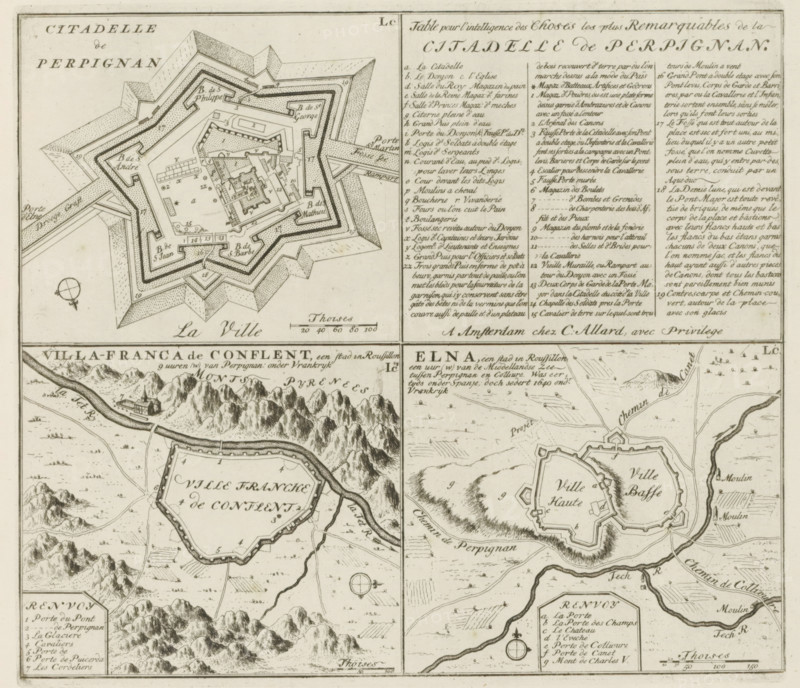
Perpignan and other cities in Rousillon, Citadelle de Perpignan, Table pour l'intelligence, de la Citadelle de Perpignan, Villa-Franca de Conflent, Elna, Les Principales Forteresses & Villes Fortes, d'Espagne, de France, d'Italie, de Savoië, d'Allemagne & des Païs-Bas, Accurate Illustrations of the Main Strong Cities and Fortresses in Spain, France, Italy, Savoy, Germany and the Netherlands, print, album page, map, The fortress of Perpignan with legend. Below it two other places in Rousillon. With texts in Dutch and French., printmaker: Abraham Allard, Amsterdam, printmaker: Carel Allard, publisher: Pieter van der Aa (I), Leiden, grantor of privilege: States of Holland and West Friesland, 1701 - 1733, paper, etching, height 228 mm x width 258 mm, fortifications, military engineering, maps of cities, War of Spanish Succession, Perpignan, Elne, Languedoc-Roussillon, Villefranche-de-Conflent, Period, 1701 - 1713, A detailed engraved map divided into panels showing fortified towns and surrounding terrain, with star-shaped citadel plans, concentric walls, bastions, moats, bridges, and labeled interior blocks; areas of hachured hills and clustered mountains, winding rivers and roads, scattered small buildings and mills, compass roses, and rectangular legend panels filled with dense handwritten entries; the engraving uses fine stippling and line shading, with decorative title lettering and scale bars, all rendered in sepia-toned ink on aged paper.
Crédit
Photo12/Liszt Collection
Notre référence
LZT26B29_138
Licence
Droits gérés
Format disponible
44.8Mo (9.0Mo) / 36.1cm x 31.1cm / 4264 x 3670 (300dpi)