Légende
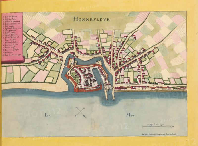
Honnefleur, Map of Honfleur, area plan, print, album page, This print is part of an album., after drawing by Jacques Gomboust, publisher: Caspar Merian, Frankfurt am Main, colorer (graphic design artist): Anna Beeck, The Hague, 1657, printmaker, colorer (graphic design artist), Hessen, paper, engraving, etching, hand coloring, etching and engraving, hand colored, cut inside the plate edge and pasted in a hand-colored frame, height 187 mm x width 285 mm, height 532 mm x width 318 mm, A colored map view showing a coastal town with an enclosed fortress area jutting into the water, surrounded by a water moat and connected to the mainland by a bridge, the fortress containing clustered buildings and wall structures with red roofs and beige walls, the mainland area showing streets lined with small rectangular houses with red roofs and beige walls, patchwork agricultural fields in pastel greens and pinks beyond the streets, a pale blue sea at the bottom, a yellow border framing the map, and a rectangular inset panel on the left with a vertical list blocked by a pink background.
Crédit
Photo12/Liszt Collection
Notre référence
LZT26B23_371
Licence
Droits gérés
Format disponible
34.0Mo (9.7Mo) / 34.0cm x 25.0cm / 4012 x 2958 (300dpi)