Légende
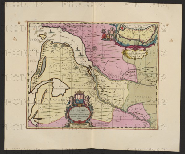
La Riviere de la Garomne et la Dordogne et la pays aux environs de Bourdeavx; map of Bordeaux region, 1711. Maker: Pieter Schenck 1660–1711; publisher: Gerard Valck 1651/1652–1726. Cartography; map; dimensions: height 43.0 cm, width 51.8 cm., A colored antique map sheet showing a rectangular map frame centered on a cream background with a dark outer margin; the map interior features regions filled with pale yellow and pale pink washes, with thin black grid lines and darker hand-drawn coastlines and rivers; decorative cartouches appear at top right and bottom center with small painted human figures and ornamental scrollwork in colors including red, blue, green, gold, and flesh tones; small stylized ships and clusters of short black strokes suggestive of waves or topographic marks appear in the sea and land areas; thin black ink place marks and small pictorial trees or hills are scattered across the pale areas; the map border is outlined in red and black, and the sheet shows small foxing spots and light crease marks.
Crédit
Photo12/Liszt Collection
Notre référence
LZT26A06_304
Licence
Droits gérés
Format disponible
86.0Mo (6.6Mo) / 50.8cm x 42.4cm / 6000 x 5011 (300dpi)