Légende
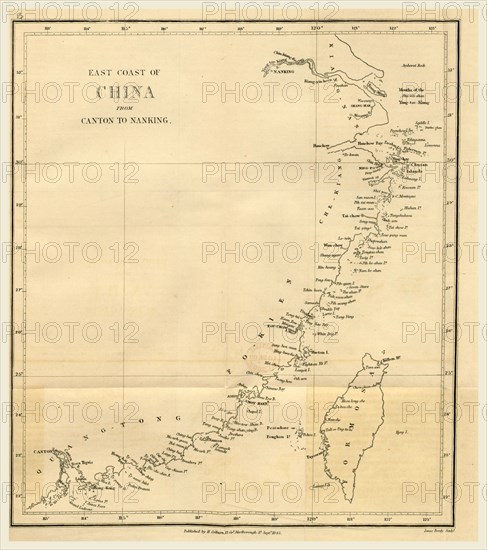
Topographical Map of the East coast of China from Canton to Nanking. Narrative of the Voyages and Services of the Nemesis, from 1840 to 1843, and of the combined naval and military operations in China, 19th century engraving
Date
1843
Crédit
Photo12/Liszt Collection/Quint Lox Limited
Notre référence
LZT16A63_236
Licence
Droits gérés
Format disponible
105.0Mo (3.1Mo) / 48.3cm x 54.5cm / 5701 x 6435 (300dpi)