Sujet
The Chitral Expedition: the Chitral Valley, 1895. Creator: George Meisenbach.
Légende
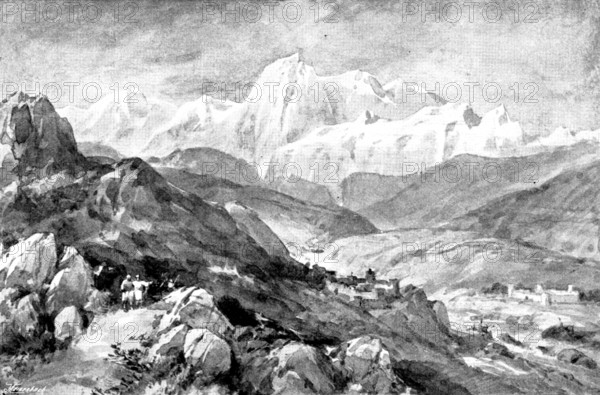
The Chitral Expedition: the Chitral Valley, 1895. 'The town of Chitral is situated about one hundred and thirty miles in a straight line due north of Peshawur; the country which is known by the same name extends from the town away to the north-east, and leads to the Baroghil Pass - 12,000 ft. above the sea...This pass is over the eastern end of the Hindu Kush, and may be said to be the point where the Himalayan range bends and runs westward through Afghanistan to the Heri Rud, on the frontier of Persia. The Hindu Kush forms the northern boundary of Chitral...The Chitral Valley is at times spoken of as Kashkar, which is its older name...The plan of operations from the Peshawur Valley is across the frontier by the Malakand and Shahkot passes into the Swat Valley, and from that through Panjkora to Dir, from which a pass leads over to the Chitral Valley...The view we are enabled to give of the Valley will convey some idea of the wild mountainous character of the country in which the present campaign has to carry on its operations...The column under Colonel Kelly, which is operating from Gilgit, is stopped at Ghizr, owing to the snowstorms in the pass leading over to the Chitral Valley at Mastuj. It was expected to reach Laspur about April 4'. From "Illustrated London News", 1895.
Crédit
Photo12/Heritage Images/The Print Collector
Notre référence
HRM26A08_195
Model release
NA
Property release
NA
Licence
Droits gérés
Format disponible
10.4Mo (1.2Mo) / 19.9cm x 13.1cm / 2351 x 1550 (300dpi)