Sujet
Sketches in Madagascar, 1883. Creator: Unknown.
Légende
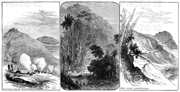
Sketches in Madagascar: distant view of Antananarivo; Andraka Ferry Mt. Angavo; pass near Ambatomanga, 1883. 'The island of Madagascar, in the Indian Ocean, separated by the Mozambique Channel from the east coast of South Africa, is one of the largest islands of the world...In the north and east parts of the island extensive table-lands, at a height of 3000 ft. to 5000 ft., occupy much of the interior, with mountains here and there rising to 8000 ft. or 9000 ft...Granite mountain ranges, and other hills of igneous rock formation, with extinct volcanic craters, traverse the lower lands; there are many rivers, but few of these are navigable ; a belt of dense forest, some fifteen miles broad, encircles nearly the whole island...the interior highlands have a salubrious and agreeable climate. Our Illustrations, from sketches by Captain S. P. Oliver, R.A., give a fair notion of some of the scenery on the road from Tamatave, the chief commercial port of the east coast, to Antananarivo, the capital city of the Hova kingdom...The city of Antananarivo, situated far inland, among the hills, has a population reckoned at from eighty to a hundred thousand'. From "Illustrated London News", 1883.
Crédit
Photo12/Heritage Images/The Print Collector
Notre référence
HRM25A50_148
Model release
NA
Property release
NA
Licence
Droits gérés
Format disponible
19.8Mo (2.2Mo) / 31.2cm x 15.9cm / 3680 x 1879 (300dpi)