Sujet
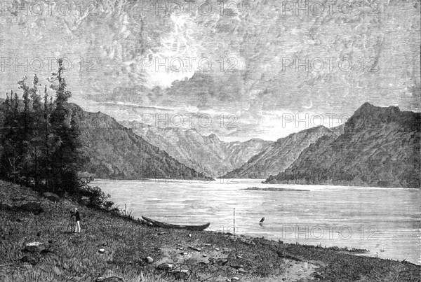
Sketches in British Columbia: mouth of the River Skeena, 1881. Creator: Unknown.
Légende
Sketches in British Columbia: mouth of the River Skeena, 1881. 'The most westerly province of British America, or rather of the confederated group of colonial provinces now styled "the Dominion of Canada," is British Columbia, with the annexed Vancouver Island, constituting the Pacific Ocean shores and inland territory...British Columbia alone is nearly twice as large as Great Britain, and is, though mountainous, as capable of being made productive and populous as the Atlantic provinces...having a much more genial climate, a vast store of mineral wealth, most valuable forests and fisheries, and some tracts of fertile agricultural soil. It wants the Canadian Pacific Railway, now under construction, to cross the Rocky Mountain range and to connect it with the navigation of the St. Lawrence and the commerce of Europe. The resources of Vancouver Island are likewise considerable, but as yet imperfectly developed; it possesses, however, in the coal-mines of Nanaimo...The river Skeena, with its outlet to the sea at Fort Simpson, immediately north of Queen Charlotte Island, has been found navigable by small steamers, and may possibly be rendered of great service in opening the trade of the North-west Territory of Canada'. From "Illustrated London News", 1881.
Crédit
Photo12/Heritage Images/The Print Collector
Notre référence
HRM25A43_178
Model release
NA
Property release
NA
Licence
Droits gérés
Format disponible
24.5Mo (3.1Mo) / 30.2cm x 20.3cm / 3566 x 2401 (300dpi)