Sujet
Sketches of the Gulf of St. Lawrence, Lower Canada: the Rock Percé, sketched from a yacht..., 1881. Creator: Unknown.
Légende
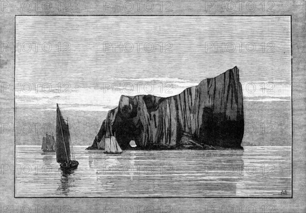
Sketches of the Gulf of St. Lawrence, Lower Canada: the Rock Percé, sketched from a yacht approaching the shore, 1881. 'The shores of the Gulf of St. Lawrence, open to navigation only in summer, with the estuary of the great River St. Lawrence, constituting the highway of maritime traffic for the vast Dominion of Canada, during the better part of the year, present some of the finest coast scenery in the Western World. The Gulf is entered, in general, by the wide passage south of Cape Ray, Newfoundland, between that island and Cape Breton; but the Allan steam-ships at the proper season, and with favourable weather, can make a shorter voyage from Liverpool and Londonderry, by the Strait of Belleisle, north of Newfoundland. After crossing the Gulf westward, the vessel approaches Cape Gaspé, and a neighbouring point which is called Percé, from the Rocher Percé, or Pierced Rock, a natural phenomenon caused by the action of the waves...This region is still, to a great extent, covered with magnificent forests, which supply valuable timber for the export trade'. From "Illustrated London News", 1881.
Crédit
Photo12/Heritage Images/The Print Collector
Notre référence
HRM25A42_294
Model release
NA
Property release
NA
Licence
Droits gérés
Format disponible
22.5Mo (2.8Mo) / 28.5cm x 19.8cm / 3363 x 2343 (300dpi)