Sujet
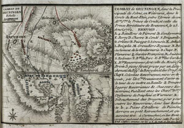
Seven Years War (1756-1763): Map of the Combat of Grüningen (25 August 1762), 1765. Creator: Jean de Beaurain.
Légende
Seven Years War (1756-1763): Map of the Combat of Grüningen (25 August 1762), 1765. Southeast-oriented map of the area between Grüningen, Holzheim and Langgöns in the principality of Solms. Map showing the positions of the Allied troops commanded by Hereditary Prince Ferdinand of Brunswick (red) and the French led by Louis-Joseph prince de Condé (1736-1818 (blue). This action was won by the Allied army. Published in 1765 by the cartographer Jean de Beaurain (1696-1771) as an illustration of his "Great Map of Germany, with the events that took place during the War of the Seven Years". French edition, 1765.
Crédit
Photo12/Heritage Images/PRISMA ARCHIVO FOTOGRÁFICO, S.L.
Notre référence
HRM25A41_034
Model release
NA
Property release
NA
Licence
Droits gérés
Format disponible
46.8Mo (4.4Mo) / 41.0cm x 28.6cm / 4843 x 3375 (300dpi)