Légende
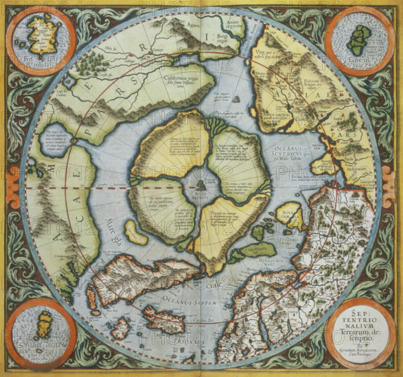
Map of the Arctic, 1595. This map speculates that the Arctic consisted of a circular landmass with a lake at its centre, out of which four large rivers flowed. It was not until 1896 that the Arctic was in fact determined to consist of a frozen ocean, when Fridtjof Nansen's ship, the Fram, drifted across the Arctic locked in the ice, proving that no continent existed.
Date
1595
Crédit
Photo12/Heritage Images/Heritage Art
Notre référence
HRM25A14_495
Model release
NA
Property release
NA
Licence
Droits gérés
Format disponible
50.0Mo (4.2Mo) / 36.6cm x 34.2cm / 4319 x 4045 (300dpi)