Sujet
Map of the Kuril Islands with Surrounding Areas, 1700-1799. Creator: Unknown.
Légende
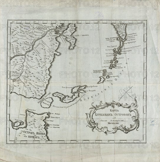
Map of the Kuril Islands with Surrounding Areas, 1700-1799. This 18th century Russian map depicts the Kurile Islands archipelago, located on the far eastern edge of the Russian Empire. Although inaccurate in places, the map attempts to show the large and small islands throughout the entire chain. Most of the Kurile Islands are listed by name, a geographical specificity quite unusual for such a remote region in this era. As with the nearby Aleutian Islands, by this time these islands had been repeatedly visited by both Russian maritime explorers and hunters of sea otter. Sakhalin Island is also seen toward the upper center of the map, alongside the Russian mainland, as is the Kamchatka Peninsula toward the upper right. Some rivers, lakes, and other bodies of water are listed by name. Relief is indicated pictorially in places. Northern Japan, principally Hokkaido, is shown toward the lower left of the map. Geographic coordinates for longitude on this map are measured from Ferro (present-day Hierro), the westernmost of the Canary Islands (the western edge of the world known to the ancients), used by geographers back to the time of Ptolemy as a base point prior to the agreement in 1884 that the prime meridian would run through Greenwich, England.
Crédit
Photo12/Heritage Images/Heritage Art
Notre référence
HRM24A00_117
Model release
NA
Property release
NA
Licence
Droits gérés
Format disponible
70.7Mo (5.4Mo) / 41.9cm x 42.3cm / 4943 x 4998 (300dpi)