Sujet
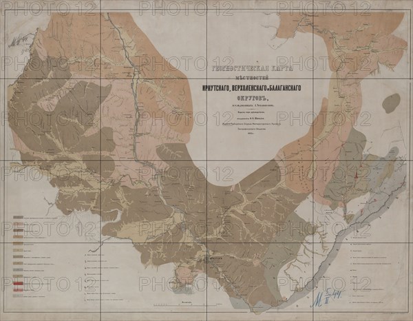
Geognostic Map of the Localities of Irkutsk, Verkholensk, and Balagansk Districts, 1873. Creator: Siberian Branch of the Russian Geographic Society.
Légende
Geognostic Map of the Localities of Irkutsk, Verkholensk, and Balagansk Districts, 1873. The first geological (geognostic) maps in Russia were produced in the 1850s. This map of the Irkutsk region was published by the Siberian Department of the Imperial Russian Geographic Society under the leadership of Academician F.B. Schmidt. It shows the location of mines and minerals, caves, gaps, salt deposits, springs, landslides, and patterns of freezing on Lake Baikal. The colors denote different types of rock.
Crédit
Photo12/Heritage Images/Heritage Art
Notre référence
HRM24A00_115
Model release
NA
Property release
NA
Licence
Droits gérés
Format disponible
373.1Mo (15.4Mo) / 109.6cm x 85.3cm / 12946 x 10073 (300dpi)