Sujet
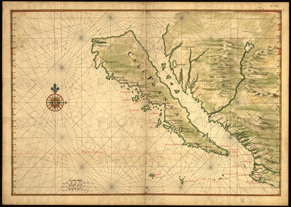
Map of California shown as an island, c 1650. Creator: Johannes Vingboons.
Légende
Map of California shown as an island, c 1650. This map from around 1650 shows California as an island. A half-century would pass before Spanish explorers determined with certainty that California was connected to the mainland of North America. Place names are carefully indicated on the map in red and black, and include, for example, Cape San Lucas (at the tip of present-day Baja California), Mexico, and the Tres Maria Islands off the coast of the Mexican mainland. Joan Vinckeboons (1617-70) was a Dutch cartographer and engraver born into a family of artists of Flemish origin. He was in the employ of the Dutch West India Company and produced maps for over 30 years for use by Dutch mercantile and military shipping. He was a business partner of Joan Blaeu, one of the most important map and atlas publishers of the day. Vinckeboons drew a series of 200 manuscript maps that were used in the production of atlases, including Blaeu's Atlas Major.
Crédit
Photo12/Heritage Images/Heritage Art
Notre référence
HRM24A00_101
Model release
NA
Property release
NA
Licence
Droits gérés
Format disponible
159.2Mo (13.2Mo) / 74.8cm x 53.3cm / 8831 x 6301 (300dpi)