Sujet
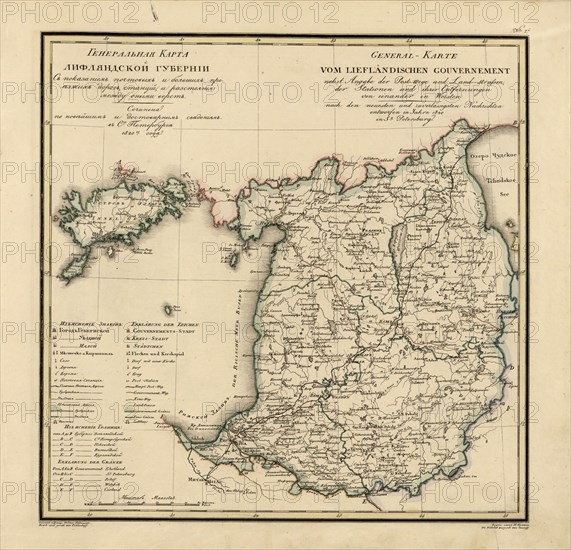
General Map of Livland Province: Showing Postal and Major Roads, Stations and the..., 1820. Creators: Vasilii Petrovich Piadyshev, Iwanoff.
Légende
General Map of Livland Province: Showing Postal and Major Roads, Stations and the Distance in Versts between Them, 1820. This 1820 map of Livland Provinceis from a larger work,Geograficheskii atlas Rossiiskoi imperii, tsarstva Pol'skogo i velikogo kniazhestva Finliandskogo(Geographical atlas of the Russian Empire, the Kingdom of Poland, and the Grand Duchy of Finland), containing 60 maps of the Russian Empire. Compiled and engraved by Colonel V.P. Piadyshev, it reflects the detailed mapping carried out by Russian military cartographers in the first quarter of the 19th century. The map shows population centers (six gradations by size), postal stations, roads (four types), provincial and district borders,taverns, and customs houses. Distances are shown in versts, a Russian measure, now no longer used, equal to 1.07 kilometers.Legends and place-names are in Russian and German. The territory depicted on the map corresponds to the southern part of present-day Estonia and the northern part of present-day Latvia.
Crédit
Photo12/Heritage Images/Heritage Art
Notre référence
HRM24A00_061
Model release
NA
Property release
NA
Licence
Droits gérés
Format disponible
66.6Mo (4.5Mo) / 41.6cm x 40.1cm / 4917 x 4735 (300dpi)