Sujet
Map of the mining district of California, 1851. Creator: William A. Jackson.
Légende
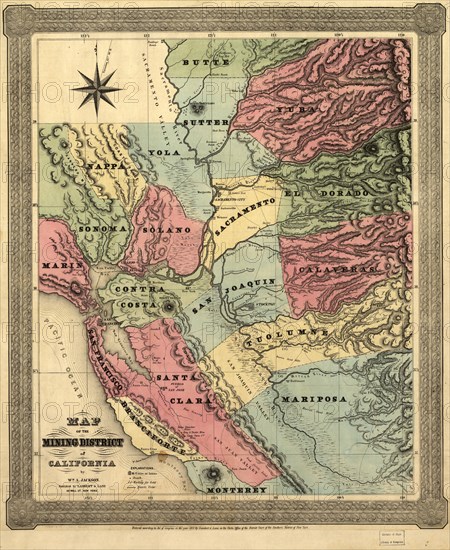
Map of the mining district of California, 1851. This map, produced in two parts in the early years after the California Gold Rush of 1849, shows the regions where gold was discovered in the territory. Accompanying the map was a 16-page appendix that gave further information on the location and significance of the gold strikes. The discovery of gold at Sutter's Mill on the American River in January 1848 attracted migrants from the east coast of the United States, as well as from Europe, Central and South America, Australia, and Asia. The Treaty of Guadalupe Hidalgo ending the Mexican-American War, signed within two weeks of the discovery at Sutter's Mill, made California a U.S. territory after centuries of control by Spain and Mexico. The influx of some 300,000 people accelerated the pace of political change in the territory. Captain William A. Jackson, the cartographer, was an engineer who had personal experience of the mines. The map and appendix shown here were published in 1851 and are revised from the first edition produced in 1850. Accompanied by: Appendix to Jackson's map of the mining districts of California. 16 p ; 15 cm. LC Trails,
Crédit
Photo12/Heritage Images/Heritage Art
Notre référence
HRM24A00_017
Model release
NA
Property release
NA
Licence
Droits gérés
Format disponible
124.7Mo (12.3Mo) / 50.6cm x 61.8cm / 5974 x 7297 (300dpi)