Sujet
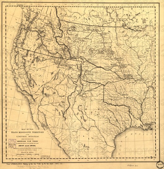
Map of the Trans-Mississippi of the United States during the period of the American fur..., 1902. Creator: Hiram Martin Chittenden.
Légende
Map of the Trans-Mississippi of the United States during the period of the American fur trade as conducted from St. Louis between the years 1807 and 1843, 1902. This map, published in 1902 in H.M. Chittenden's History of the Fur Trade of the Far West, shows major cartographic features of the American West in the early 19th century, including the location of key Native American populations, forts, trading posts, and physical features, such as mountains and rivers. French voyageurs pioneered fur trading and trapping in Canada and the American West before the Louisiana Purchase of 1803, but the basic geography of this vast region was poorly understood before the Lewis and Clark expedition of 1804-6. Following the expedition, the fur trade rapidly expanded in the region between the Mississippi River and the Pacific Ocean. One of the most famous American fur traders, John Jacob Astor, established his Pacific Fur Company in 1810 near the mouth of the Columbia River in Astoria, Oregon.
Crédit
Photo12/Heritage Images/Heritage Art
Notre référence
HRM24A00_013
Model release
NA
Property release
NA
Licence
Droits gérés
Format disponible
115.8Mo (8.6Mo) / 53.0cm x 54.7cm / 6260 x 6465 (300dpi)