Sujet
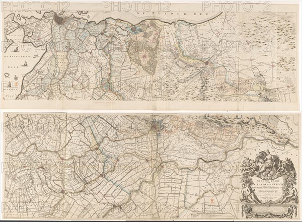
Map of the province of Utrecht, consisting of two parts, 1743. Creators: Gerard Hoet, Thomas Doesburgh.
Légende
Map of the province of Utrecht, consisting of two parts, 1743. At the bottom right the title cartouche, coat of arms of the Archdiocese of Utrecht. Above, a female figure with four towers on her head, in one hand the horn of abundance and in her other hand a corn sheaf. Around the cartouche a river god with a female counterpart and putti with attributes that refer to hunting, agriculture, peat extraction and fishing. Under the cartouche an advertisement for the printer. Various handwritten additions have been made.
Crédit
Photo12/Heritage Images/Heritage Art
Notre référence
HRM23A89_184
Model release
NA
Property release
NA
Licence
Droits gérés
Format disponible
136.9Mo (16.2Mo) / 68.3cm x 50.2cm / 8066 x 5934 (300dpi)