Sujet
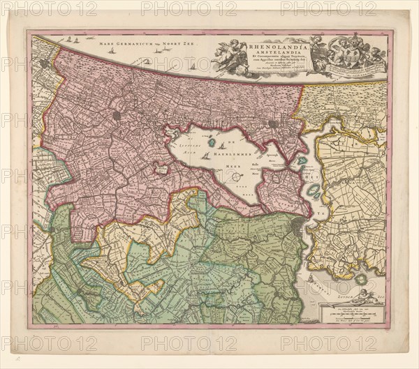
Map of Rijnland and Amstelland, c.1675. Creator: Workshop of Nicolaes Visscher.
Légende
Map of Rijnland and Amstelland, c.1675. 'Rhenolandia, Amstelandia et circumjacentia aliquot territoria: cum aggeribus omnibus terminisq. suis'. West is at the top, with North Sea coast; right: title in cartouche carried by Putti, coat of arms and helmet above dedication to Johannes Hudde. Below right: scale in Dutch and French miles, just above putto holding pair of compasses (1: 180,000). Attributed to the workshop of Nicolaes Visscher.
Crédit
Photo12/Heritage Images/Heritage Art
Notre référence
HRM23A89_097
Model release
NA
Property release
NA
Licence
Droits gérés
Format disponible
74.4Mo (6.6Mo) / 46.0cm x 40.6cm / 5430 x 4792 (300dpi)