Sujet
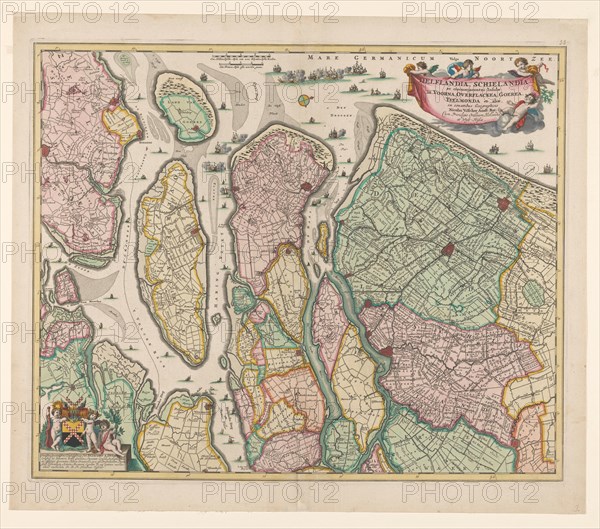
Map of South Holland, c.1675. Creator: Nicolaes Visscher.
Légende
Map of South Holland, c.1675. With the west above. Scale in Dutch and French miles. Warships in a naval battle on the North Sea, the mouths of the Haringvliet and the Maas. At the bottom left Putti with the coat of arms of Jacob van der Dussen. (1: 180,000).
Crédit
Photo12/Heritage Images/Heritage Art
Notre référence
HRM23A89_094
Model release
NA
Property release
NA
Licence
Droits gérés
Format disponible
74.6Mo (6.8Mo) / 46.0cm x 40.6cm / 5436 x 4794 (300dpi)