Sujet
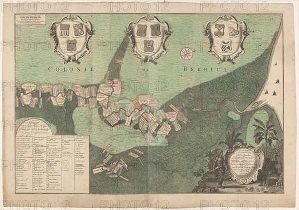
Accurate Map of the state and the course of Rio de Berbice..., 1742. Creators: Jan Daniel Knapp, Hendrik de Leth.
Légende
Accurate Map of the state and the course of Rio de Berbice. Located with the same Plantation in the Colony of Berbice, 1742. Map, on two sheets, of the Dutch West India Company colony of Berbice, showing the plantations along the Berbice and Canje rivers. Bottom left: 'Name list of the owners of the Plantations located on Rio de Berbice and Rio de Canje in the Colonie de Berbice': Total 113. Above: three cartouches with coats of arms. Cartouche with an indigenous resident of Guyana and an enslaved man. (The region along the Berbice River in Guyana was a colony of the Dutch West India Company between 1627 and 1792).
Crédit
Photo12/Heritage Images/Heritage Art
Notre référence
HRM23A88_139
Model release
NA
Property release
NA
Licence
Droits gérés
Format disponible
128.5Mo (12.3Mo) / 67.6cm x 47.6cm / 7986 x 5626 (300dpi)