Sujet
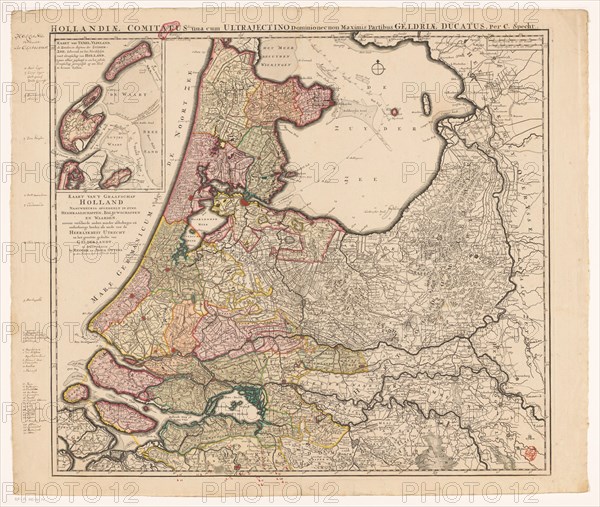
Map of Holland, Utrecht and part of Gelderland, 1726-1727. Creator: Caspar Specht.
Légende
Map of Holland, Utrecht and part of Gelderland, 1726-1727. Map of the county of Holland, the seigneury of Utrecht and most of the Duchy of Gelderland. Texel and Vlieland in the top left. Below that the Dutch title. At the top right two scales: German and French miles. Possibly by Caspar Specht.
Crédit
Photo12/Heritage Images/Heritage Art
Notre référence
HRM23A87_195
Model release
NA
Property release
NA
Licence
Droits gérés
Format disponible
83.2Mo (6.2Mo) / 49.6cm x 42.0cm / 5864 x 4960 (300dpi)