Sujet
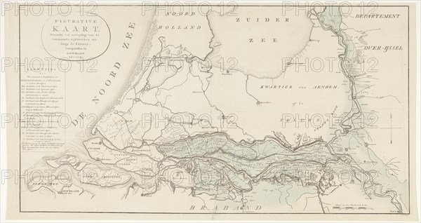
Figurative map, giving an indication of the main dike breaches, etc.: along the Rivers, 1809. Creator: Antoni Zürcher.
Légende
Figurative map, giving an indication of the main dike breaches, etc.: along the Rivers, 1809. The area affected by flooding between the large rivers and along the IJssel in the centre of the Netherlands, during the flood of January 1809. On the left the legend with the most important dike breaches marked with the letters A-N.
Crédit
Photo12/Heritage Images/Heritage Art
Notre référence
HRM23A87_135
Model release
NA
Property release
NA
Licence
Droits gérés
Format disponible
76.1Mo (3.8Mo) / 60.0cm x 31.8cm / 7082 x 3754 (300dpi)