Sujet
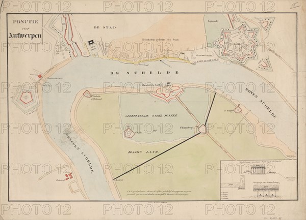
Map of Antwerp during the siege by the French, 1832, (1832-1833). Creators: Anon, Johannes Paulus Houtman.
Légende
Plan showing Schelde and Antwerp with the location of the forts in Dutch hands, during the siege of the Citadel by the French, 1832, (1832-1833). Dutch gunboats on the Scheldt. At the bottom right an inset with two images of a battery on the citadel.
Crédit
Photo12/Heritage Images/Heritage Art
Notre référence
HRM23A87_064
Model release
NA
Property release
NA
Licence
Droits gérés
Format disponible
60.2Mo (2.4Mo) / 45.7cm x 33.0cm / 5397 x 3898 (300dpi)